Travel Medicine
Business Travel Medicine
Easily manage your reservations and stay constantly updated on Ambimed services.

|
Country Name |
Republic of India |
|
Continent |
Asia |
|
Surface area |
3,287,263 km² |
|
Capital |
New Delhi |
|
Population |
1,267,401,849 (2014 estimates) |
|
Language |
Hindi |
|
Currency |
Indian Rupee (INR) |
|
Time zone |
+4.5hrs in relation to Italy |
|
Area code for Italy |
0039 |
|
Area code from Italy |
0091 |
There have been no relevant reports in the past 90 days.
All unvaccinated travelers over 9 months of age who (1) come from at-risk countries visited in the 6 days prior to entering India, (2) have transited via at-risk countries by leaving the airport (exemptions in this case are to be checked with local authorities) or arrive on a ship that has visited ports in at-risk areas in the 30 days prior to arrival, are detained for a quarantine period of up to 6 days.
Vaccinations are recommended given the presence of outbreaks in the country. The main transmission vector is consumption of food or water; poor hygienic conditions promote its spread.
Endemic throughout the country, this infection mostly affects the pulmonary tract but as it progresses it can also involve other parts of the body. It is transmitted from human to human through the saliva (also coughs and sneezes) of infected people.
There are numerous groups of stray dogs roaming in packs in India. Travelers should be aware that Rabies represents a public health problem.
Present in some areas of the country, transmission is more likely during the rainy season, however the risk remains throughout the year. Infected mosquitos are the vector of Japanese encephalitis. Consider taking the vaccine if you plan a long stay in rural areas during the monsoon period (May/October).
Endemic throughout the country it affects the motor neurons in the central nervous system. Polio is transmitted via fecal/ oral means from infected food or water or saliva from sick individuals or healthy carriers. The vaccine is the most effective prevention tool.
Polio vaccination certificate (performed at least 4 weeks before departure) is required for all travelers residing in countries where it is endemic or from countries where the disease is present as a result of importation.
Present year-round below 2,000 metres, the greatest risk is found in the northeastern states, Andaman and Nicobar Islands, Chhattisgarh, Gujarat, Jharkhand, Karnataka (except the city of Bangalore), Madhya Pradesh, Maharasthra (except the cities of Mumbai, Nagpur, Nasik, and Pune), Orissa, and West Bengal (except the city of Kolkata). Chemo-prophylaxis is recommended if you are planning long stays in rural areas during the monsoon period.
There are numerous cases reported within the country. The main vector is the aedes aegypti type mosquito, which proliferates in wetlands and standing water, especially in the rainy season.
In 2018, an outbreak of Nipah Virus caused numerous deaths in the state of Kerala. There is currently no specific vaccine for this virus, which is transmitted among specific fruit bats but spreads from other animals to people. Therefore, it is recommended not to consume fruit with damaged skin and avoid exposure to bats and pigs.
The following vaccinations are strongly recommended as these diseases can be contracted anywhere in the world. Experts advise that you protect yourself and other travellers by making sure you are up-to-date with all of the recommended vaccinations. This will allow you to travel safely, while minimising the risk of exposure to infection.
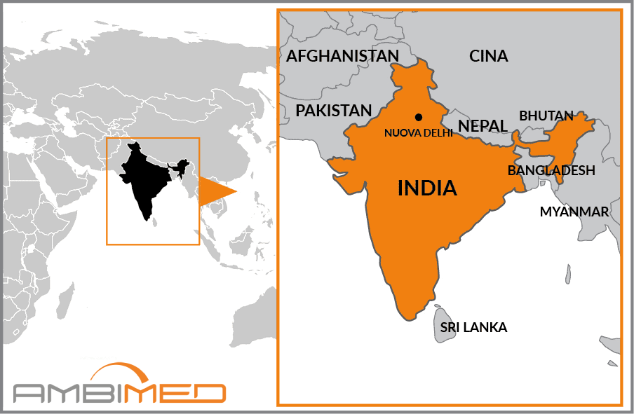
India is a state in South Asia, the second most populous in the world. It is bordered to the northwest by Pakistan, to the northeast by China, Nepal, and Bhutan, and to the east by Myanmar and Bangladesh. For more than 7,000 km it is bounded by the Indian Ocean, which on its eastern side forms the Bay of Bengal. he Laccadive Islands archipelago in the Arabian Sea and the Andaman and Nicobar archipelagos in the Bay of Bengal form part of its territory.
The northern part of the country is occupied by the southern slope of the Himalayan range, which in India rises from west to east and reaches its highest peak on Nanda Devi (7,816 m). The northern end of the country (the Jammu and Kashmir region) penetrates the Himalayan mountain range in the most glacier-rich area. Slightly to the south, the immediate sub-mountainous zone is occupied by a series of lower elevations that are highly seismic. These mountains are rich in streams with flourishing vegetation. Still farther south is the Ganges plain that separates the Himalayan ranges from the Deccan Plateau, a vast peninsular region framed by other mountain ranges with much lower elevations: Monoakti Aravalli to the northwest with the Western Ghati and Eastern Ghati to the south respectively, converging south of the peninsula. The eastern coastal strip is wide and sandy occupied by numerous lakes and coastal ponds; the western coastal strip is steeper and deeper, marked by ravines.
The elements that influence India's climate are undoubtedly its wide range in latitude, the Indian Ocean and the imposing northern ranges. The country nonetheless remains within the tropical monsoon belt, and rainfall marks seasonality: dry winter and rainy summer; with the exception of the Himalayan regions not affected by the monsoons, which receive rainfall even during winter.
Average temperatures generally exceed 20°C with temperature ranges that become more pronounced proceeding northward where, moreover (in the Punjab or Rajasthan regions) temperatures below 0° are frequently recorded. The monsoon season begins in June, blowing from the southwest coastal belt and slowly reaching the rest of the territory.


